District Overview
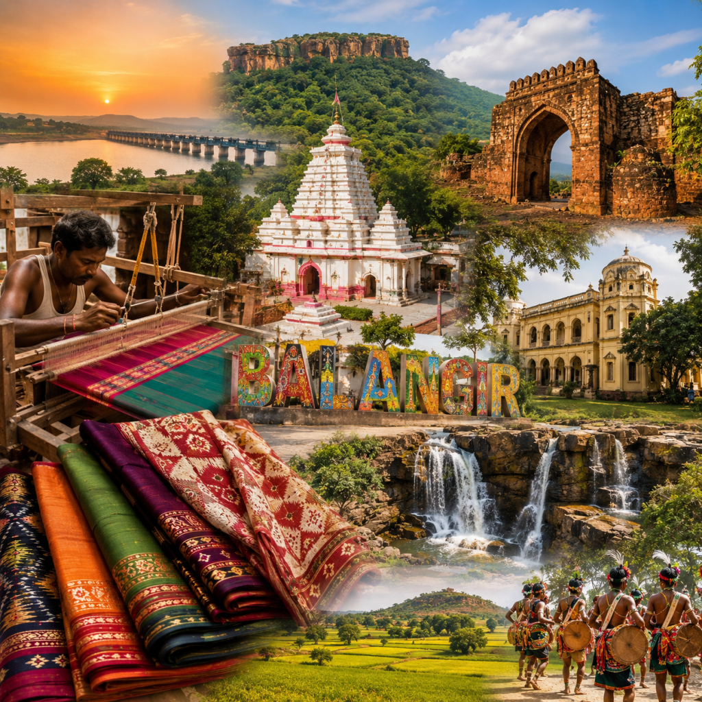
The district is blessed with hills, forests, rivers, waterfalls, reservoirs, and picturesque rural landscapes that offer opportunities for tourism and nature-based activities. Its temples and historical sites add to its spiritual and architectural importance, while traditional villages provide visitors with an opportunity to experience the region’s distinctive cultural heritage. With continuous improvements in road connectivity, public infrastructure, education, healthcare, agriculture, and other sectors, Balangir is steadily progressing towards sustainable development while preserving its rich traditions and identity.Balangir therefore represents a harmonious blend of heritage, culture, agriculture, nature, tradition, and development, making it a distinctive and significant district of Odisha.Traditional weaving and handicrafts also play an important role in the local economy, reflecting the creativity and skills of the people of Balangir.
Total Towns information.
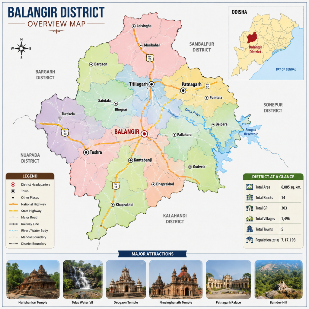
Balangir district has a well-developed network of urban centres that play an important role in the social and economic development of the region. These towns serve as key centres for administration, trade, education, healthcare, transportation, banking, public services, and various commercial activities. They also provide essential facilities and employment opportunities to people living in nearby villages and rural areas.According to district records based on the 2011 Census, Balangir district has five towns: Balangir, Titilagarh, Patnagarh, Kantabanji, and Tushra. Balangir, the district headquarters, serves as the primary administrative and commercial centre of the district. Titilagarh is an important town known for its transportation and commercial activities, while Patnagarh has historical and cultural significance. Kantabanji functions as an important trading and transportation centre, and Tushra contributes to the economic activities and development of the surrounding region.
Demographic Overview
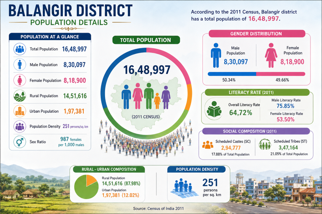
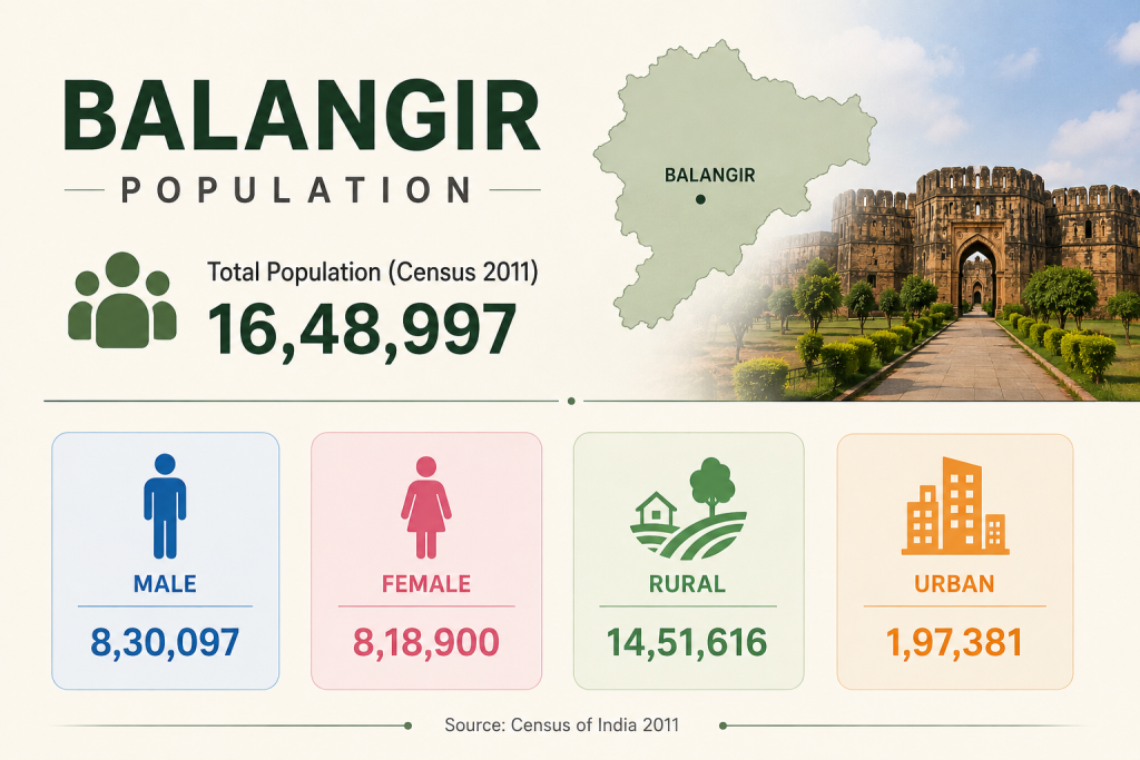
According to the 2011 Census, Balangir district had a total population of 16,48,997, comprising 8,30,097 males and 8,18,900 females. The population is predominantly rural, with 14,51,616 people living in rural areas, while 1,97,381 people reside in urban areas. The district recorded a population density of 251 persons per square kilometre, reflecting its predominantly rural character.The district has a diverse population, with Scheduled Castes accounting for 17.88% and Scheduled Tribes accounting for 21.05% of the total population. Literacy has also shown significant progress, with the district recording an overall literacy rate of around 64.72% in the 2011 Census. Male literacy stood at 75.85%, while female literacy was 53.50%.
Population Overview
Balangir district, situated in the western region of Odisha, is known for its rich cultural heritage, historic significance, and predominantly rural character. According to the 2011 Census, the district has a total population of 16,48,997, comprising 8,30,097 males and 8,18,900 females. A significant majority of Balangir’s population resides in rural areas, with around 14,51,616 people living in rural regions, while 1,97,381 people reside in urban areas. This distribution highlights the district’s strong connection with its rural communities and traditional way of life. This demographic profile provides an important foundation for understanding the district’s development needs and planning for improved infrastructure, public services, education, healthcare, and economic opportunities..
Balangir District at a Glance
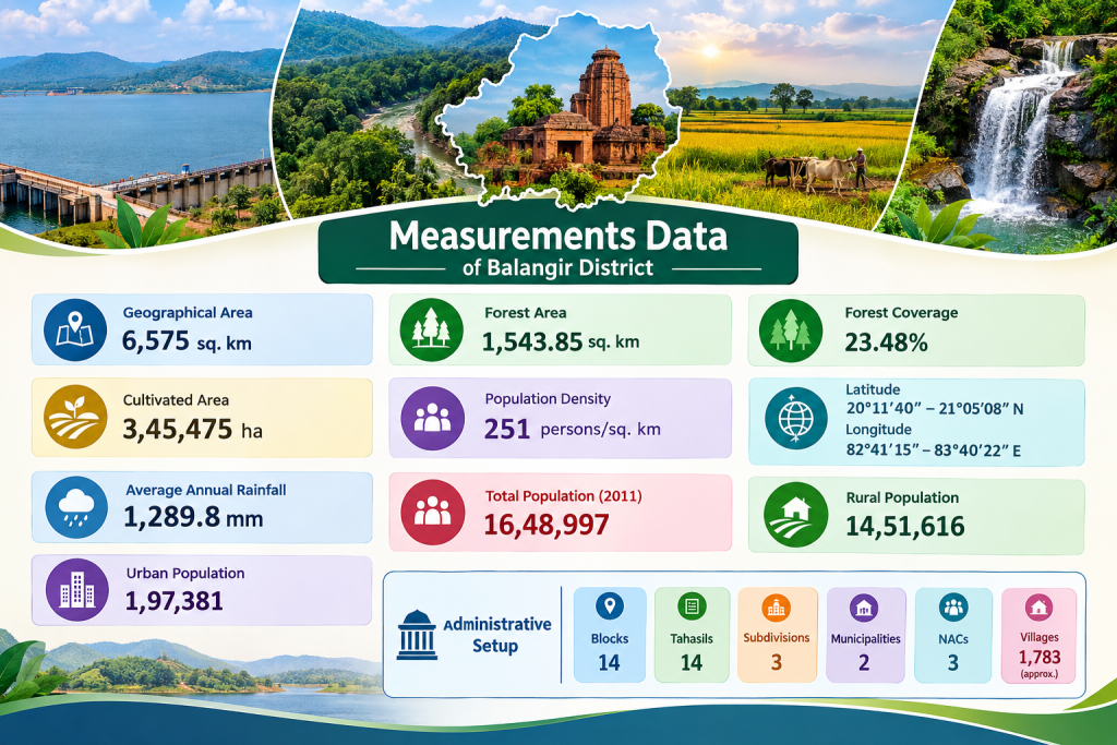
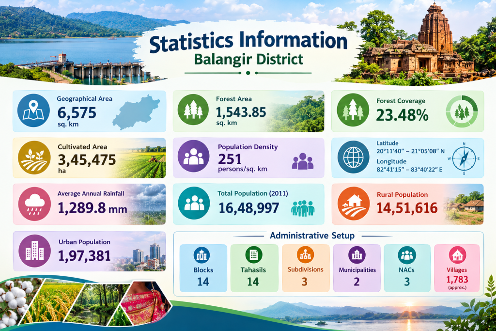
Balangir district covers a geographical area of 6,575 sq. km and is characterized by a diverse landscape of agricultural land, forests, rivers, and settlements. The district has a population density of approximately 251 persons per sq. km, with forests covering about 23.48% of its total area. Agriculture occupies a significant portion of the district, with around 3.45 lakh hectares under cultivation. Balangir experiences an average annual rainfall of approximately 1,290 mm. Geographically, the district extends between 20°11′40″ and 21°05′08″ North latitude and 82°41′15″ and 83°40′22″ East longitude, reflecting its broad geographical spread within western Odisha.
Key Statistics of Balangir District
Balangir district presents a diverse demographic, geographical, and administrative profile. It covers an area of 6,575 sq. km and had a total population of 16,48,997 according to the 2011 Census. The district has a population density of 251 persons per sq. km, with 14,51,616 people living in rural areas and 1,97,381 in urban areas. Administratively, Balangir comprises 14 blocks, 14 tahasils, 3 subdivisions, 2 municipalities, 3 NACs, and approximately 1,783 villages. Agriculture is an important part of the district’s economy, while forests cover around 23.48% of its geographical area. These statistics provide an overview of Balangir’s population distribution, land use, natural resources, and administrative structure.
Historical Heritage of Balangir District
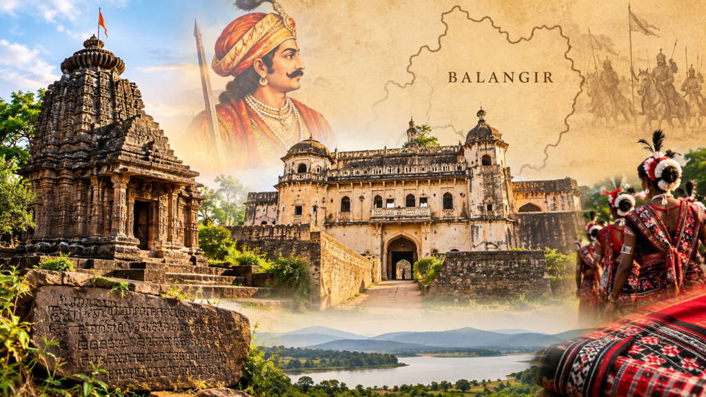
Balangir has a rich historical heritage with roots in the ancient South Kosala region. Over the centuries, the region was influenced by several dynasties, including the Sarvapuriya, Panduvamsi, Somavamsi, Telugu Cholas, Kalachuris, Gangas and Chauhans. In the 14th century, Chauhan ruler Ramai Deo established the Patna State, which became an important political centre in western Odisha.The history of modern Balangir is closely connected with the Patna State. Balaram Deo, a prominent Chauhan ruler, established Balaramgarh, which later became known as Balangir. Patnagarh served as the earlier capital, while Balangir gradually developed into an important administrative centre.